


Find Your Walk Companion
Tell us where you're at on your walking journey — we'll point you to the right route, planner, and keepsake.

Walking the Great Glen Way? You're not the only one.
From first-time long-distance walkers to seasoned regulars, the Great Glen Way is a trail people come back to. See who's walking it at the same time as you.

Baggage Transfer, The Great Glen Way

Bank Street Lodge, Fort William
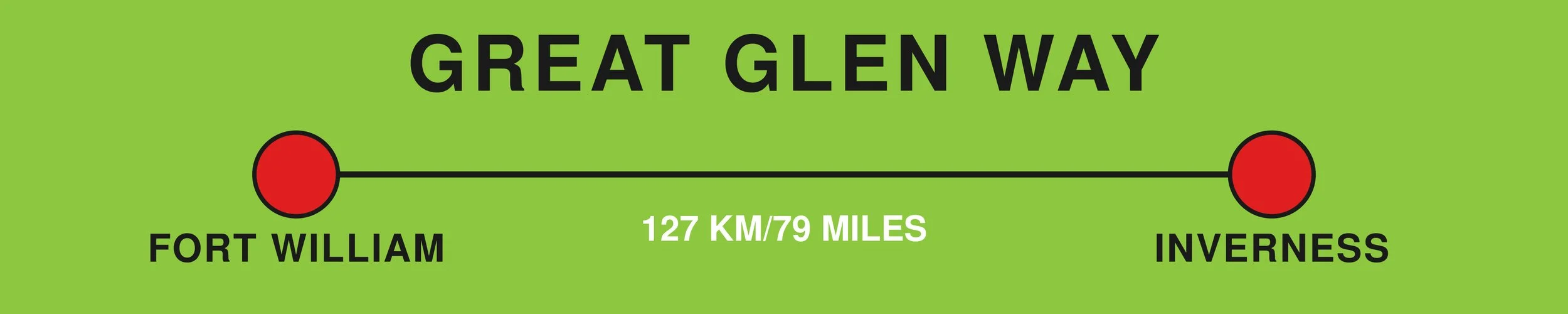
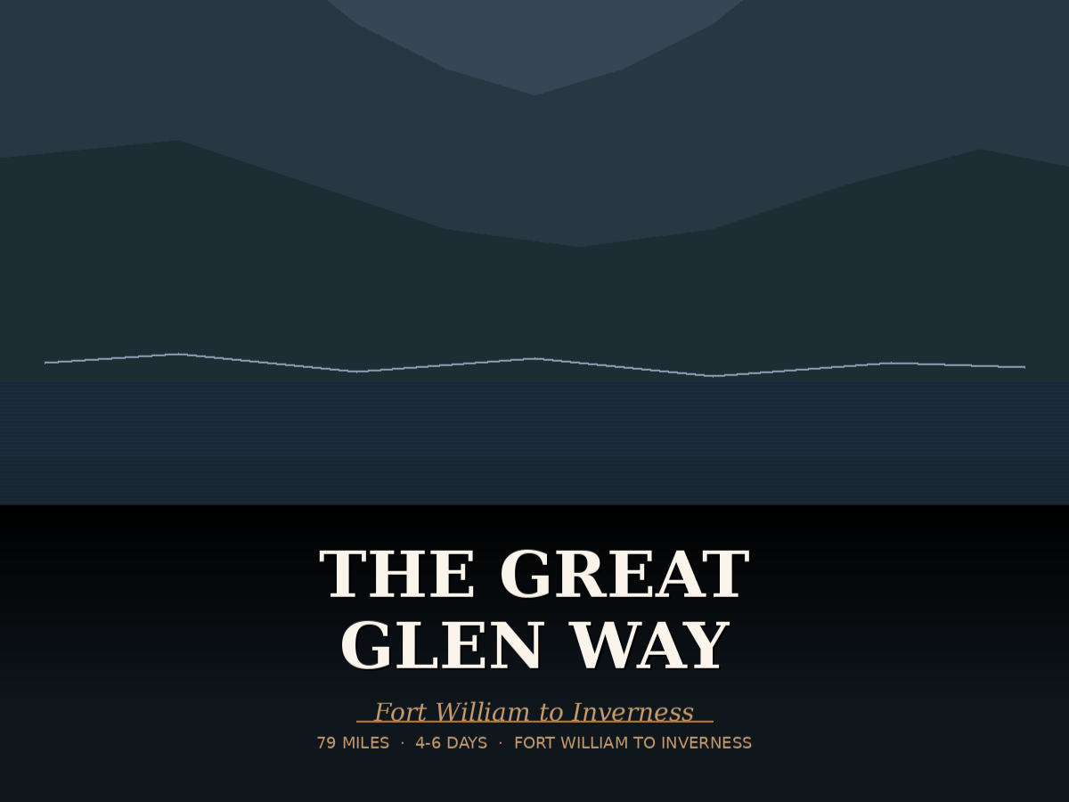
Opened in 2002, The Great Glen Way follows the natural fault line of the Great Glen which divides Scotland from coast to coast. Stretching for 127km (79 miles) across the Highlands from Fort William to Inverness, it can be walked in either direction, but walking towards Inverness puts the sun and the prevailing wind behind you.
The Great Glen Way is a good introduction to long-distance walking for less experienced walkers, as most of the route is straightforward walking on lower level tracks and paths. There is however a high level option between Fort Augustus and Drumnadrochit, rewarding a little more effort with more dramatic views.
Much of the route follows the towpath of the Caledonian Canal, and runs the entire length of Loch Lochy, Loch Oich and the forests above Loch Ness, the latter enjoying some steep climbs. The main challenge for most walkers comes on the final stage, with an 18 mile hike from Drumnadrochit to Inverness.
Before You Set Off
Although the Great Glen Way offers a more gradual route, preparation still plays a big part in your comfort along the way. With long distances between stops, a supportive pair of walking boots will keep you comfortable day after day. A dependable waterproof jacket is also important, as conditions can change quickly along the lochside paths. Carrying a practical backpack ensures you have everything you need within easy reach.
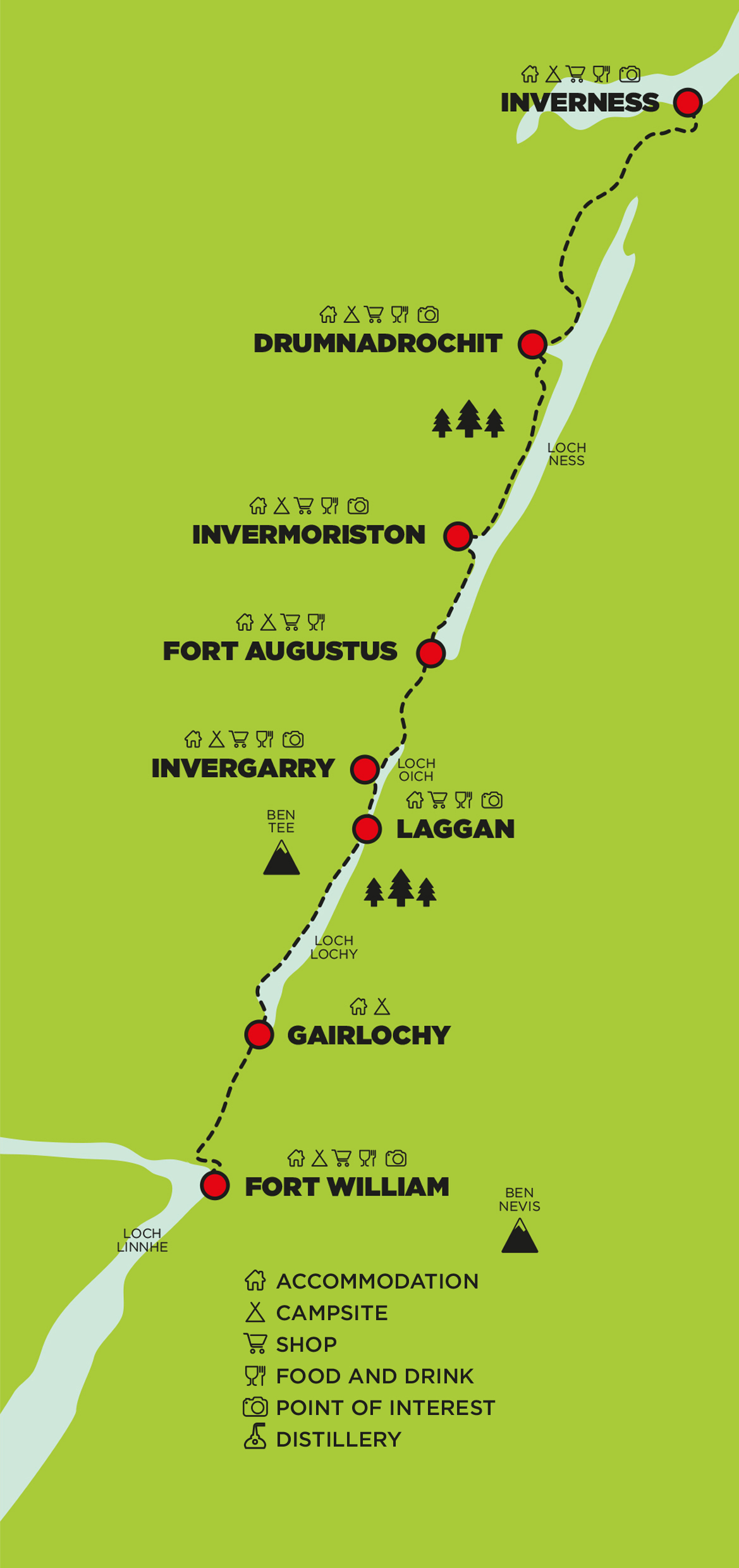
STAGE 1:
Fort William to Gairlochy
(17km/10.5m)

Starting at the official marker for the Great Glen Way in the centre of Fort William, the majority of the walk on day one follows the Caledonian Canal towpath. Fort William is overshadowed by Ben Nevis, although views of the mighty mountain are very dependent on cloud levels!
You’ll walk through the outskirts of the town and join the Caledonian Canal, which flows into Loch Linnhe. A highlight of this stage is Neptune’s Staircase, the longest staircase lock in the UK, which takes the canal to over 19m above sea level.
The east bank of the canal heads all the way into the tiny village of Gairlochy, providing a good flat walk and excellent views of the mountains around you.
ACCOMMODATION | CAMPING | SHOPS | FOOD & DRINK | VISITOR ATTRACTIONS
STAGE 2:
Gairlochy to Laggan
(19km/12m)

This section of the walk is very scenic, with super views of Loch Lochy as you follow the route along the western shore of the loch.
The World War II Commando Boat Stationat Achnacarry was situated on Loch Lochy
at Bunarkaig. A small fleet of various craft was assembled for training in basic seamanship and landing drills, and you can see the remains of a WWII landing craft on the shores of the loch.
The forestry path climbs at this stage, providing a good track through woodland above the loch. It crosses the canal to reach Laggan, which comprises two separate settlements, North Laggan and South Laggan. They are about a mile apart and both situated between Loch Lochy and Loch Oich.
ACCOMMODATION | CAMPING | SHOPS | FOOD & DRINK | VISITOR ATTRACTIONS
STAGE 3A:
Laggan to Fort Augustus
(17km/10.5m)

The third section is one of the loveliest on the Great Glen Way. From Laggan, the track climbs up into the forest to meet the abandoned Invergarry and Fort Augustus railway line, which runs along the eastern shores of the beautiful Loch Oich. This loch is rich in wildlife, and every autumn Atlantic salmon migrate from the sea and use Loch Oich, Loch Lochy and Loch Ness as their spawning nests.
The route rejoins the Caledonian Canal towpath at Aberchalder and continues into Fort Augustus, which is situated on the southern end of Loch Ness. From here you might like to take a cruise of the loch.
ACCOMMODATION | CAMPING | SHOPS | FOOD & DRINK | VISITOR ATTRACTIONS
STAGE 3B:
Laggan to Fort Augustus
including Invergarry link
(21km/13m)

The Invergarry Link is an alternative route running along the western side of Loch Oich, which gives you access to the facilities in Invergarry.
The route splits off from the Great Glen Way just above Laggan Locks, and follows a minor road and then forestry tracks into Invergarry. You’ll rejoin the main walk beyond Loch Oich, onto the Caledonian Canal towpath into Fort Augustus.
ACCOMMODATION | CAMPING | SHOPS | FOOD & DRINK | VISITOR ATTRACTIONS
STAGE 4A:
Fort Augustus to Invermoriston
Low route
(12km/7.5m)

This section gives you two options – a low route or a high route, with the latter rewarding some extra climbing with even better views.
The low route follows forest tracks and paths above Loch Ness with some short, steep slopes. If timber harvesting is taking place, you will need to take the high route, or follow the diversion signs.
Refer to the next page for the high route details.
ACCOMMODATION | CAMPING | SHOPS | FOOD & DRINK | VISITOR ATTRACTIONS
STAGE 4B:
Fort Augustus to Invermoriston
HIGH route
(12km/7.5m)

The high route - on this section and the next - was opened in 2014. Walking above the tree line for more than ten miles, you’re rewarded with some great views over Loch Ness.
From Fort Augustus, you leave the canal and climb up into the forest above Loch Ness. The track rises and falls through woodland and the path is narrow in parts, but it mostly follows good forest tracks.
The route winds downhill into the village of Invermoriston, where you’ll find facilities including toilets and a shop. As this stage is shorter, you might choose to combine it with the next part of the walk to Drumnadrochit.
ACCOMMODATION | CAMPING | SHOPS | FOOD & DRINK | VISITOR ATTRACTIONS
STAGE 5A:
Invermoriston to Drumnadrochit
LOW route
(23.5km/14.5m)

Route Update (2026):
This section offers both a low-level and a high-level route.
The low route starts with a steep climb out of Invermoriston before levelling out through forests on the north side of Loch Ness. Along the way you'll enjoy occasional views across the loch to the hills beyond.
The route now follows a new off-road section through Bunloit Estate, replacing the former roadside stretch. Passing through native woodland, Scots pine forest, peatland restoration areas and open moorland, this quieter and more scenic section offers improved views across Loch Ness before rejoining the trail near Clunebeg.
From here, the route descends steeply into Drumnadrochit. As you approach the village, you'll pass the famous Urquhart Castle and the Loch Ness Visitor Centre.
ACCOMMODATION | CAMPING | SHOPS | FOOD & DRINK | VISITOR ATTRACTIONS
STAGE 5B:
Invermoriston to Drumnadrochit
HIGH route
(22km/13.5m)

Route Update (2026):
Climbing steeply out of Invermoriston, the high route follows forest tracks high above Loch Ness, rewarding walkers with spectacular panoramic views.
After descending, the high route rejoins the low route before entering the new off-road section through Bunloit Estate, replacing the former roadside stretch. This improved section passes through native woodland, Scots pine forest, peatland restoration areas and open moorland before rejoining the trail near Clunebeg and continuing towards Drumnadrochit.
The final descent into the village brings you close to the ruins of Urquhart Castle and the Loch Ness Visitor Centre.
This stage includes some steep ascents and descents. Paths are generally well-maintained forest tracks with sections of rougher trail.
ACCOMMODATION | CAMPING | SHOPS | FOOD & DRINK | VISITOR ATTRACTIONS
STAGE 6:
Drumnadrochit to Inverness
(29km/18m)

Temporary route notice July 26: Forestry operations are affecting a short section between Drumnadrochit and Inverness. A clearly signposted diversion is in place, adding only a few hundred metres. Please follow all signs and instructions on the route.
The last stage of the Great Glen Way is a long one, so often the most challenging. The route heads away from Loch Ness, over open moorland above Drumnadrochit and through farmland and forests. On parts of the walk you’ll have good views of Loch Ness and the mountains to the north. The final stage descends to reach the River Ness which you’ll follow into Inverness, the capital of the Highlands.
This section of the walk can also be done in reverse as a day walk, starting in Inverness and finishing in Drumnadrochit – buses return from Drumnadrochit to Inverness late afternoon.
You’ve finished - congratulations on walking the Great Glen Way!
ACCOMMODATION | CAMPING | SHOPS | FOOD & DRINK | VISITOR ATTRACTIONS