


Find Your Walk Companion
Tell us where you're at on your walking journey — we'll point you to the right route, planner, and keepsake.

Walking the Southern Upland Way? You're not the only one.
With long, challenging stages, knowing who else is on the trail can make a big difference. See who's walking the Southern Upland Way at the same time as you.


The Black Bull, Lauder

The Nithsdale Hotel, Sanquhar

Images below provided courtesy of southernuplandway.gov.uk


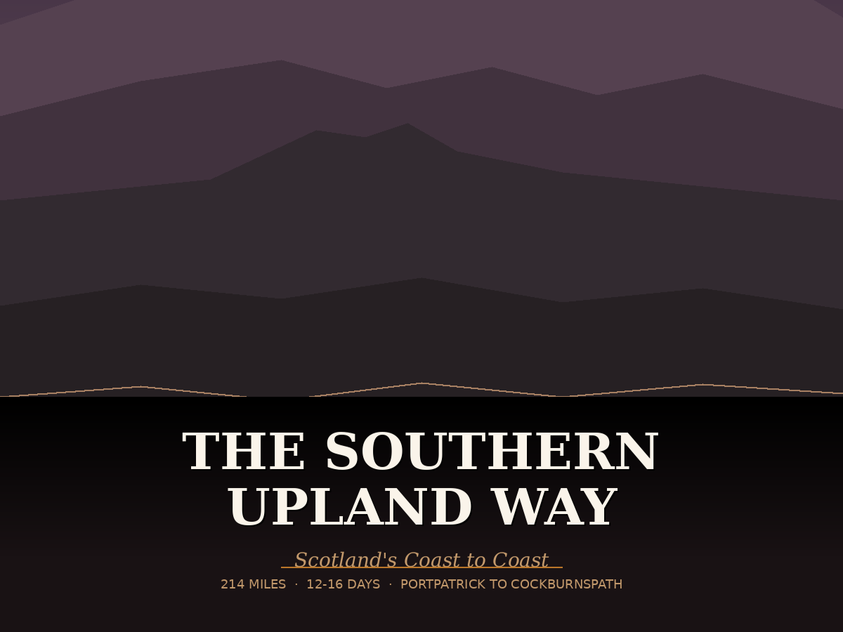
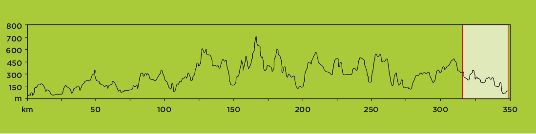
The Southern Upland Way is Scotland’s first – and only – official coast-to-coast long distance footpath. The Southern Uplands are situated in the southernmost part of Scotland and the route offers experienced walkers a real challenge at 214 miles (344 km) long. It stretches from Portpatrick on the south west Atlantic coast of Scotland to Cockburnspath on the North Sea coast, and to complete the full walk you should allow 12-14 days on average, ideally between May and September.
The route is a varied one and includes rugged cliffs, lochs, open moorlands and forests. It’s isolated in parts compared to other walks in Scotland, but you’ll have a real sense of achievement whether you complete the full coast-to-coast walk or simply enjoy one or two sections. Some of the sections are very long so you need to plan ahead and be prepared, but overall the walk is defined by its length rather than its difficulty.
Some of the longer stages can be split into two, with a stay overnight in a local village. Alternatively you can stay at one of the five mountain bothies along the route – simple rural unlocked shelters 3 of which are maintained by the Mountain Bothies Association (www.mountainbothies.org.uk); the other 2 are provided by the Southern Upland Way Rangers - you will of course need to carry sleeping and cooking gear.
Before You Set Off
As one of Scotland’s more challenging long-distance routes, the Southern Upland Way requires a bit more preparation before setting off. A durable pair of walking boots is key for handling long stretches of rugged terrain, while a reliable waterproof jacket will keep you protected from exposed conditions. A well-fitted backpack will help you manage your kit comfortably across longer, more demanding stages.
STAGE 1:
Portpatrick to Castle Kennedy
(21.7km/13.5M)

The first section of the Southern Upland Way is a comparatively short one to break you in gently! Starting at Portpatrick, you’ll walk along the dramatic coastal cliffs, with great views of Knock Bay and out to the Irish Sea. There are also great views of Killantringan lighthouse.
The route turns inland at Black Head, skirting past Stranraer through farmland, moorland and woods before reach the village of Castle Kennedy.
ACCOMMODATION | CAMPING | SHOPS | FOOD & DRINK | VISITOR ATTRACTIONS
STAGE 2:
Castle Kennedy to Bargrennan
(43.6km/27.1M)

The second section from Castle Kennedy to Bargrennan is a long one, so you may wish to walk it over two days and stop overnight at New Luce, or in the Beehive Bothy near Laggangarn.
Starting in parkland, you’ll then climb into more remote countryside, passing through wild moorland and forests. As this area is further away from populated areas, you should always carry a map and a compass. The majority of the walking in this section is on roads and forest tracks, but some of the rougher moorland paths can get wet in places.
ACCOMMODATION | CAMPING | SHOPS | FOOD & DRINK | VISITOR ATTRACTIONS
STAGE 3:
Bargrennan to Dalry
(41.3km/25.7M)

Another long section in remote countryside, however you can choose to walk it over two days by staying a night in the White Laggan Bothy which is within one of the UK’s only “dark sky” parks, this means that there is no light pollution so on a clear night you can pick out the stars and constellations.
This section is one of ups and downs, lochs and views. Leaving Bargrennan, you’ll walk along the banks of three rivers – the Cree, the Minnoch and the Trool – until you reach Loch Trool. Heading up onto the hills, you can enjoy some of the best scenery and views that the Southern Uplands have to offer.
Descending past Loch Dee, the path continues through Galloway Forest Park and out to Clatteringshaws Loch, before rising up onto the hills and then down again into St John’s Town of Dalry (also referred to simply as Dalry).
ACCOMMODATION | CAMPING | SHOPS | FOOD & DRINK | VISITOR ATTRACTIONS
STAGE 4:
Dalry to Sanquhar
(41.3km/25.7M)

One of the longest stretches of the walk, and also one of the most exposed, make sure you’re well prepared if you decide to tackle this section all in one day.
The route heads out of Dalry and climbs to the 580m summit of Benbrack Hill – at the top you’ll be rewarded with excellent 360 degree views of the Galloway Hills. This was once the highest point on the Southern Upland Way before it was re-routed to include Lowther Hill.
Descending through woodlands to the Polskeoch Bothy, you’ll head back up into the hills and then down into Sanquhar which sits in the Nith Valley. You may want to allow time in Sanquhar to visit the many points of interest in the town including a castle, an historic walk and the oldest Post Office in the world. There’s also good facilities here, plus a train station.
ACCOMMODATION | CAMPING | SHOPS | FOOD & DRINK | VISITOR ATTRACTIONS
STAGE 5:
Sanquhar to Wanlockhead
(12.9km/8M)

This is one of the shortest sections of the route – albeit one with climbs – that experienced walkers should be able to complete in half a day.
Heading away from Sanquhar, the Southern Uplands Way passes through farmland and by the Black Loch, before testing your legs with an ascent onto the hills. You’ll drop back down to Cogshead – ideal for a lunch stop – before climbing again over moorland and then descending into Wanlockhead.
On this section of the walk you’ll see evidence of the mining which took place in the area until the 1950s. You can visit the museum of lead mining in Wanlockhead village, which is the highest village in Scotland.
ACCOMMODATION | CAMPING | SHOPS | FOOD & DRINK | VISITOR ATTRACTIONS
STAGE 6:
Wanlockhead to Beattock
(32.3km/20.1M)

Another long section – one that you may wish to break up with a stop along the route. Brattleburn Bothy is located on this stage of the walk.
It’s a steep climb from Wanlockhead up to the summit of Lowther Hill, which is the highest point on the Southern Upland Way and features a huge ‘golf ball’ radar station, as well as southern Scotland’s only ski centre. Great views all around are your reward.
You’ll walk across the hilltops and then down to cross the Dalveen Pass. The route heads around Daer Reservoir, and into Greskine Forest, which is where you’ll find Brattleburn Bothy. A steep descent takes you into Beattock – you’ve now passed the midpoint of the Southern Upland Way!
Moffat is within easy reach from Beattock approximately 1.5 miles. This is a popular destination if you are planning to split this walk over 2 years. There is good national transport links to cities both North and South.
ACCOMMODATION | CAMPING | SHOPS | FOOD & DRINK | VISITOR ATTRACTIONS
STAGE 7:
Beattock to St Mary’s Loch
(33.7KM/21M)

This part of the Southern Upland Way is the last of the really long sections, and one that you may wish to split into two.
An inauspicious start today, crossing the A74(M) motorway as you leave Beattock. But you soon return to the peace and quiet of the Southern Uplands, passing three rivers before climbing through forest and up onto the hills looking towards Ettrick Head. Here you are standing on the watershed of Scotland – the drainage divide that separates the river systems. All water behind you flows into the Atlantic Ocean, and everything ahead of you flows into the North Sea. There is also an option of a high route or low route at this point - the high route is the “official” Southern Upland Way, on clear day this is another great spot for incredible 360 degree views.
From here the track follows Ettrick Water, later heading up into the hills and towards remote and beautiful St Mary’s Loch, the largest inland loch in the Scottish Borders.
ACCOMMODATION | CAMPING | SHOPS | FOOD & DRINK | VISITOR ATTRACTIONS
STAGE 8:
St Mary’s Loch to Traquair
(19.3KM/12M)

A shorter and easier section today, giving you time at the end to enjoy Traquair and the facilities at nearby Innerleithen.
The route continues along St Mary’s Loch for about 5km, with some lovely views of the water and surrounding hills. At the end of the loch you can take a short diversion to visit the historical landmark of Dryhope Tower. Continue across hill slopes and open moorland, with great views from the top of Blake Muir.
Dropping back down to join a minor road, you’ll pass the pretty white Traquair Church. Traquair House, Scotland’s oldest inhabited house, is also well worth a visit. You may wish to continue walking to Innerleithen, which benefits from more facilities and accommodation.
ACCOMMODATION | CAMPING | SHOPS | FOOD & DRINK | VISITOR ATTRACTIONS
STAGE 9:
Traquair to Melrose
(29.3KM/18.2M)

A relatively straightforward section today, giving you time at the end to explore Melrose.
From Traquair the route enters Elibank and Traquair Forest – just beyond that the Cheese Well. You then traverse the Minch Moor ridge, look for the artwork in the heather as you leave the forest on through Yair Hill Forest, and up to the giant cairns another great spot for magnificent views on Three Brethren.
The walk descends to the River Tweed before climbing to Galashiels. From here the walk descends again to follow the Tweed, crossing various bridges and a viaduct, finishing with a walk through meadows into Melrose.
As well as offering accommodation and facilities, Melrose is known for its historic abbey ruins – believed to be the final resting place of Robert the Bruce’s heart.
ACCOMMODATION | CAMPING | SHOPS | FOOD & DRINK | VISITOR ATTRACTIONS
STAGE 10:
Melrose to Lauder
(16.1KM/10M)

An easy walk today, giving your legs a chance to recover before tackling the final two sections of the Southern Upland Way.
You leave Melrose by crossing the Chain Bridge over the River Tweed. Some minor roads lead you to farmland, which makes up the majority of today’s section. Following tracks and woodland, the latter part of the walk passes Lauder golf course and then Lauder Old Church, a symmetrical cross-shaped church built in 1673.
Lauder is a popular market town, offering shops and accommodation. If you fancy more walking (only 2km!) you can follow the Lauder Town Trail to discover more about its local history.
ACCOMMODATION | CAMPING | SHOPS | FOOD & DRINK | VISITOR ATTRACTIONS
STAGE 11:
Lauder to Longformacus
(23.3KM/14.5M)

The route leaves Lauder through the grounds of Thirlestane Castle, which dates back to 1670. It continues onto Leader Water and then Earnscleugh Water, heading into woods. Blythe Water is crossed on a wooden footbridge, before the path climbs to wind between two plantations and then across moorland to Twin Law, standing at 447m. Here you can see Watch Water reservoir below you, which you’ll descend to and then follow the road beneath the Watch Water dam.
As you head towards Longformacus you’ll cross the Dye Water, which runs through the village.
ACCOMMODATION | CAMPING | SHOPS | FOOD & DRINK | VISITOR ATTRACTIONS
STAGE 12:
Longformacus to Cockburnspath
(29.9KM/18.6M)
Leaving Longformacus, you cross pastures and a wind farm to reach forests and woods, walking above the Whiteadder River. The path then follows the river and takes you through the little village of Abbey St Bathans, on through more forests and fields to join a minor road before crossing the busy A1. More forest and another road crossing leads you into the woodland of Pease Dean nature reserve, managed by the Scottish Wildlife Trust.
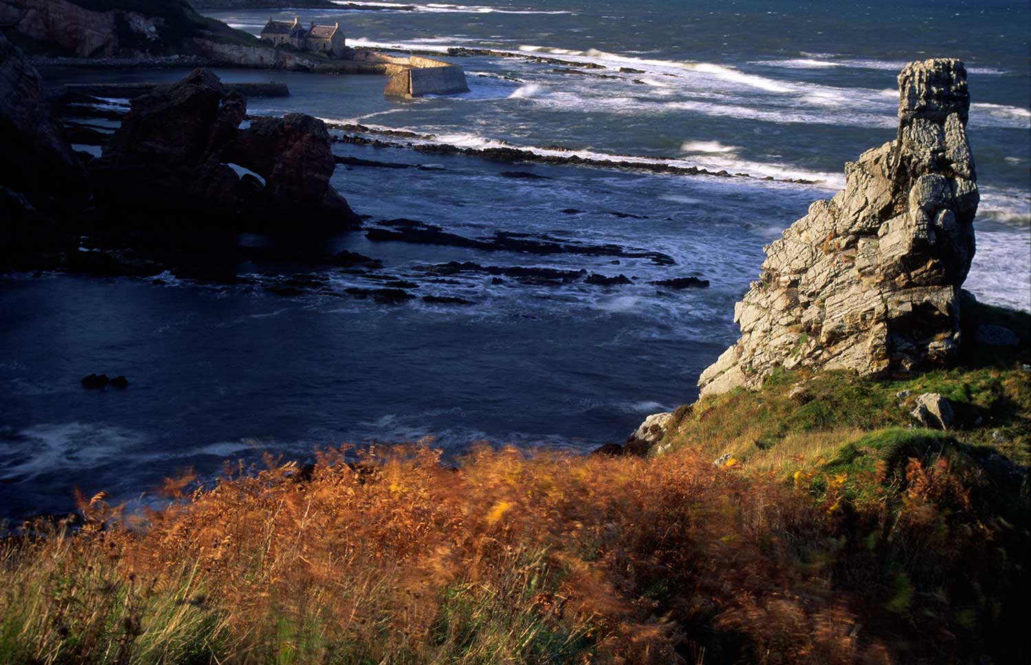
The final part of the route takes you to the clifftop overlooking Cove Harbour, with lovely views of the headlands and sandy bays along the coast. At Cove the path turns inland and heads into Cockburnspath, where you’ll reach the end of the Southern Uplands Way at the 16th century market cross in the village square. Congratulations!
ACCOMMODATION | CAMPING | SHOPS | FOOD & DRINK | VISITOR ATTRACTIONS